

The District of Columbia Office of Planning and Mayor Muriel Bowser’s office released the Robert F. Kennedy Campus Master Plan for a mixed-use development anchored by a new Washington Commanders Stadium.
The Washington, D.C. site encompasses the land where the demolished Robert F. Kennedy (RFK) Memorial Stadium was situated. The masterplan is by Gensler and is in tandem with the design by HKS for the new stadium and plans for landscaping around the sports venue by OJB.
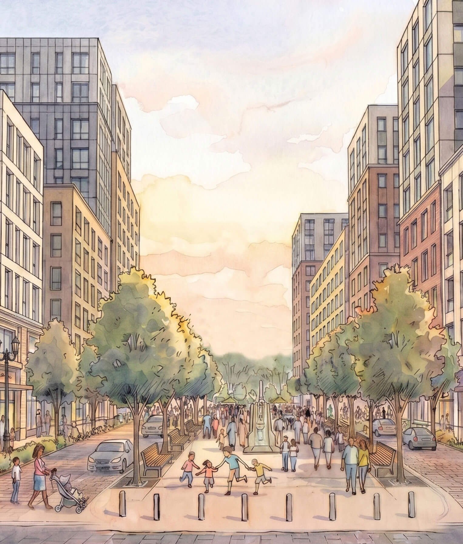
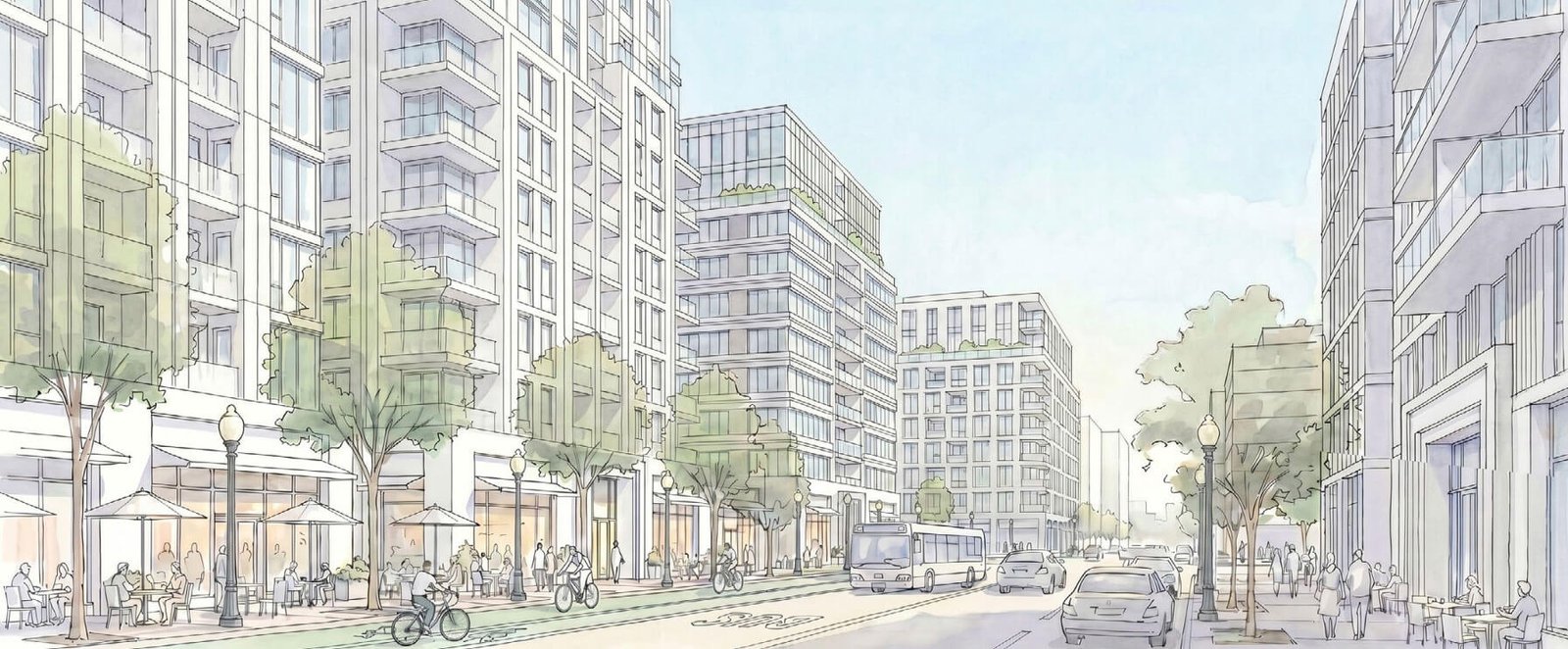
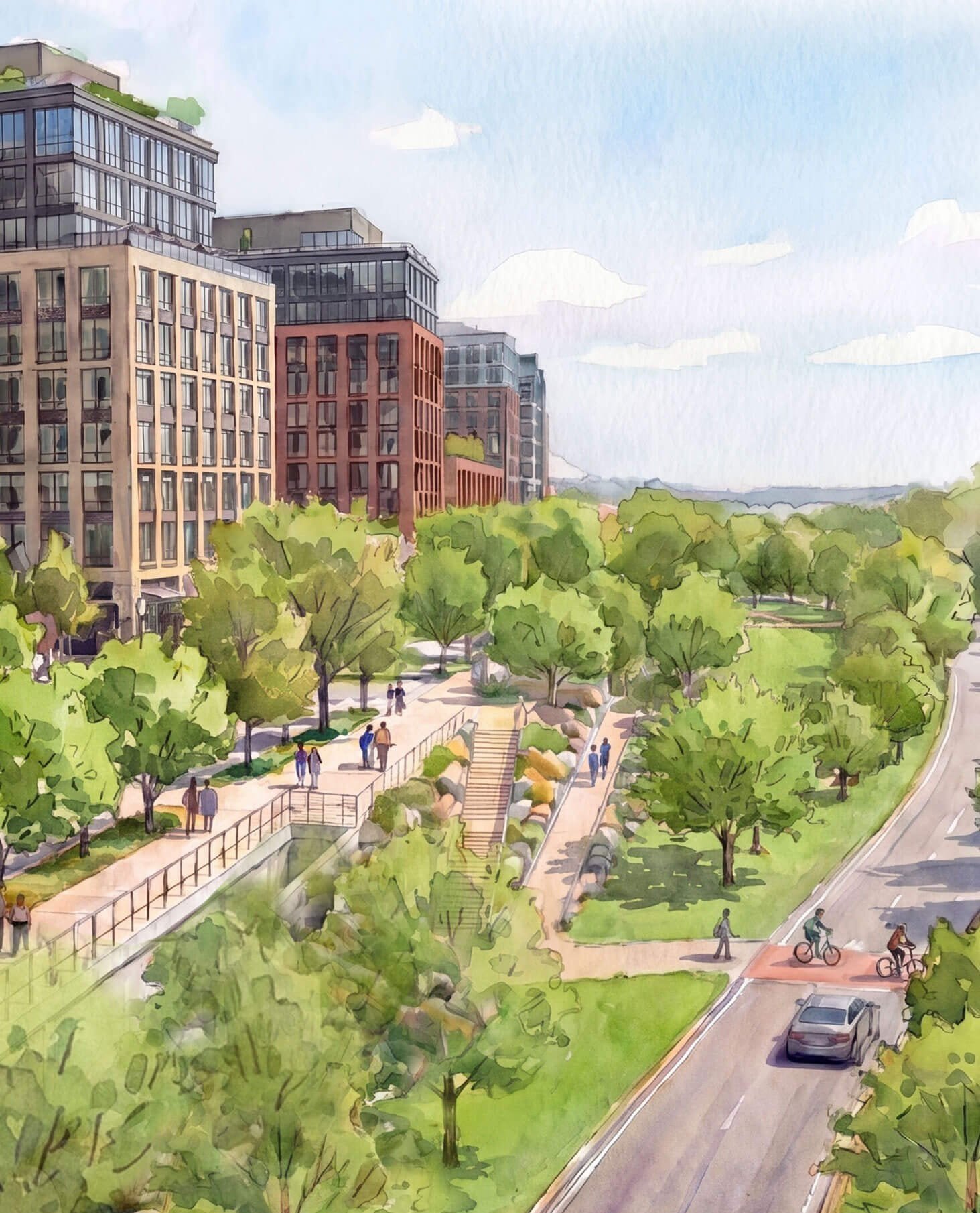
Renderings of the mixed-use neighborhood depict buildings faced in brick and glass, populated sidewalks, and walking and cycling trails toward the water’s edge.
Gensler was awarded a $750,000 contract from the city late last year for the masterplan. Per the Office of Planning, 33 events were held to gather community input from almost 1,800 participants.
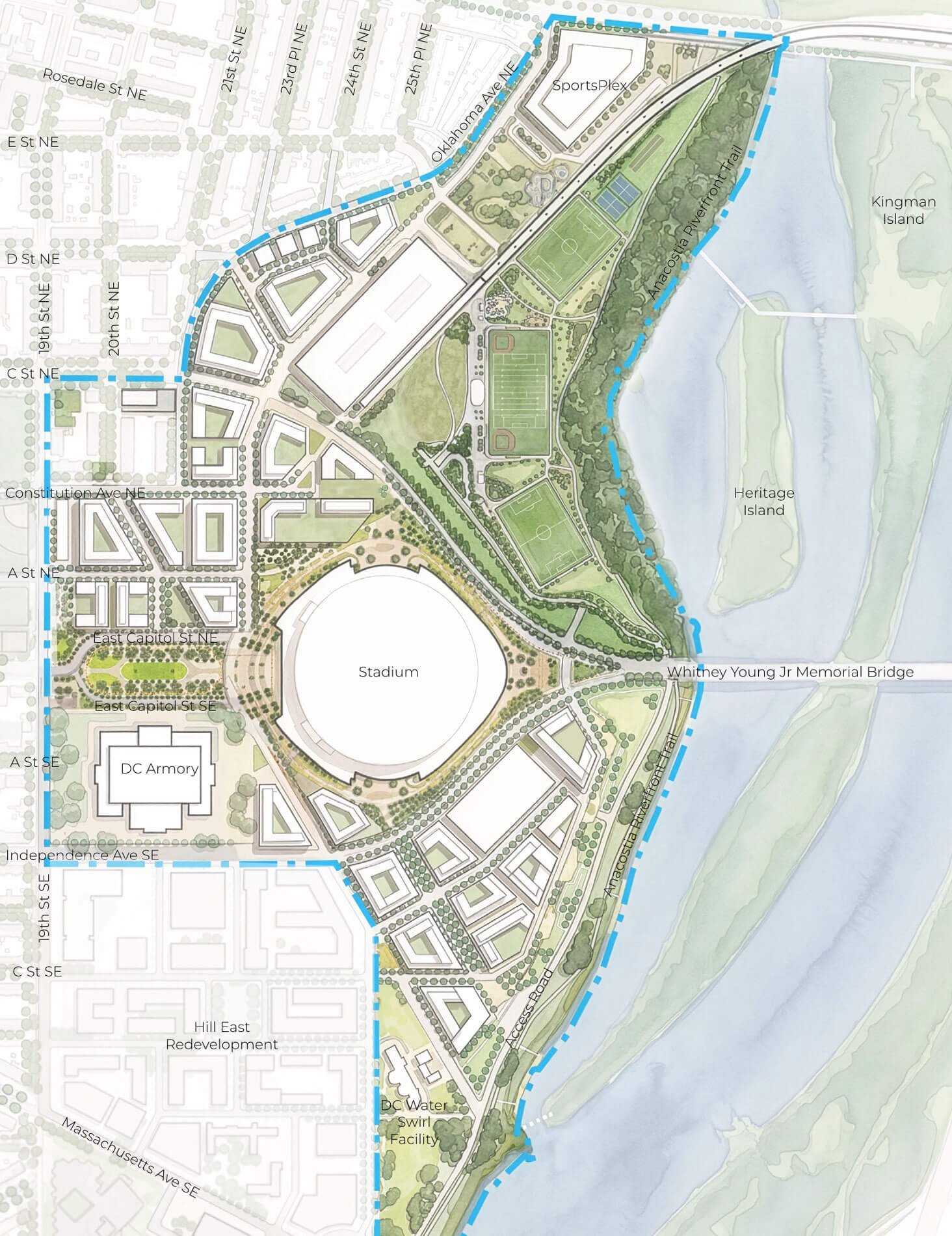
The masterplan outlines a development framework and urban design guidelines for the 180-acre site on the Anacostia River, at the terminus of the capital’s monument axis. It calls for between 5,500 and 6,500 new housing units, 30 percent affordable, and a total of 6,000 garage parking spaces.
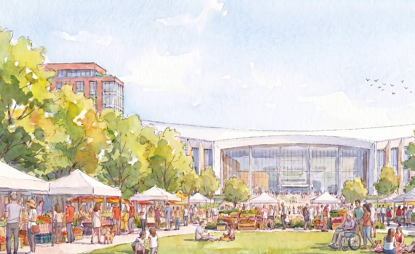
Thirty percent of the site will be given over to public space and greenery. Community-serving retail, neighborhood-centered services, and entertainment destinations could also take shape.
The new Washington Commanders football stadium will rise at most 130 feet tall. Development blocks surrounding the stadium will rise up to heights of 110 feet.
These heights are consistent with the zoning regulations of the 1910 Act to Regulate the Height of Buildings.
The masterplan organizes the campus in six parts: the stadium, plaza, riverfront, and recreation districts, and Kingman and Anacostia Commons.
Anacostia Commons will hug the riverbank, and create a 200-foot, building-free buffer between the campus and the water. The “natural riparian zone” is required by law, as part of the District’s 99-year lease for the site with the federal government.
The stadium anchors the entertainment district, with a generous entry plaza and concessions areas slated to be built around it. The plaza district will be transit-oriented and can be used for tailgating and pop-ups.
Plans for the recreation district include athletic fields and community open space. Next to the recreation district, Kingman Commons would be home to a new SportsPlex and outdoor spaces.
Arterial roads and traffic patterns will consider multimodal access by improving pedestrian safety and adding space for bikes and other transit options. A main corridor, 22nd Street, would serve as a spine for the campus.
The corridor will be multimodal, and have a dedicated bus lane, two lanes for cars, and a cycling path. Its sidewalks would be lined with restaurants, seating, and more. Secondary streets will be four-lanes wide.
In line with the 2021 District Comprehensive Plan, the masterplan seeks to rectify past spatial planning injustices that marginalized the historic Black communities in proximity to the campus, the Office of Planning said.
The masterplan addresses inequities by “making investments in public space, housing opportunities, and economic benefits in communities most affected by historic and ongoing racial disparities.”
Planners used disaggregated data to understand current neighborhood conditions and assess racial inequities related to housing access, transportation, fresh food access, and socio-economic determinants, such as educational and employment options.
Now that the masterplan has been released, a public comment period begins that lasts through August 14.
The final masterplan will be submitted to the National Capital Planning Commission in September 2026.