

grateful CABLE + Ziji Share the following content with gooood. For more information about them, please go to:CABLE on gooood, fabersociety on gooood
Appreciation towards CABLE+ fabersociety for providing the following description:
As Shenzhen welcomes the 2026 APEC meeting, the “Shenzhen Narrative” exhibition takes the city’s growth over the past forty years since reform and opening up as the main line, telling how the city continues to adjust the relationship between people and nature, city and region, technology and ecology during the process of rapid development.
As Shenzhen prepares to host APEC 2026, “Shenzhen Narratives” traces over four decades of urban growth since Reform and Opening-up, exploring how the city continually reshapes relationships between people and nature, city and region, technology and ecology.
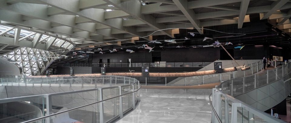
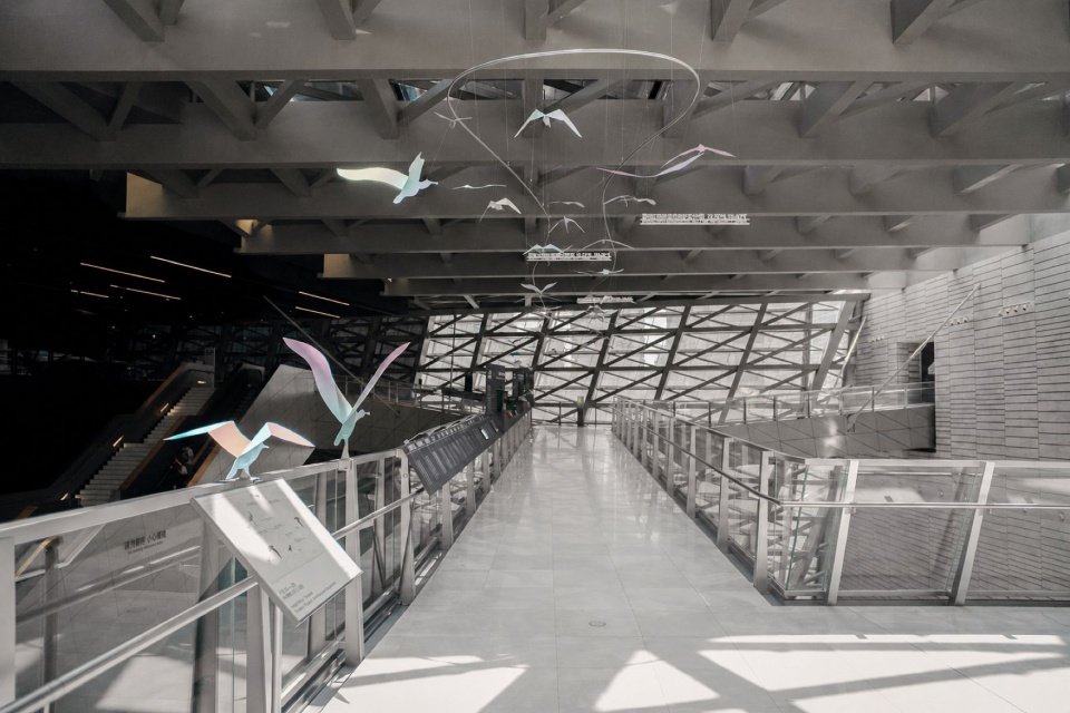
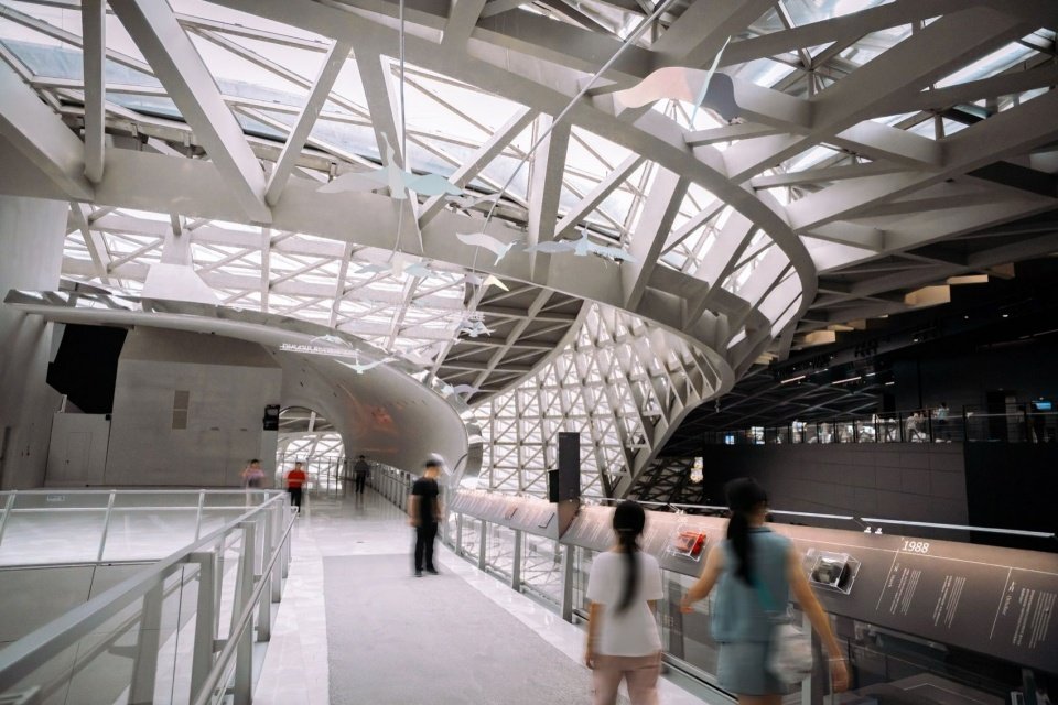
▼Panoramic view of approach bridge, Exhibition view © CABLE
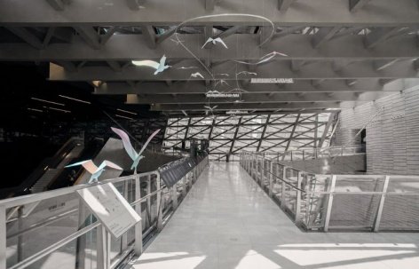
The “Interconnected Time and Space” unit located at the approach bridge of the exhibition is a horizontal walkway for the entire exhibition and a coordinate axis for re-understanding Shenzhen. The exhibition transforms the air bridge originally used for traffic into a “migration corridor”: one side unfolds Shenzhen’s urban time, and the other side uses the migration of migratory birds to present the Asia-Pacific ecological network in which Shenzhen is located. The two clues are juxtaposed along the same path, making Shenzhen’s development process no longer an isolated local history, but an urban process shaped by globalization, regional collaboration and ecological flow.
“Connected Space-Time” turns the exhibition’s elevated bridge into both a horizontal promenade and a new axis for understanding Shenzhen. This “migration corridor” pairs the city’s timeline with the Asia-Pacific ecological network revealed by migratory birds. Along one route, Shenzhen’s history emerges as a process shaped by globalization, regional cooperation and ecological flows.
▼Exhibition visual © CABLE
exhibition narrative
Exhibition Narrative
If the five-story atrium space of the two pavilions is imagined to be a magnificent river valley, the high-altitude approach bridge is the passage for people to shuttle between the civilized shores. At the same time, it is also imagined here that birds follow the eternal route and fly across the water.
Imagine the museums’ five-storey atrium as a vast river valley: the bridge becomes a passage between shores of civilization, where birds can be imagined skimming the water along ancient flight paths.
Time: the way to the city
Time: The City’s Journey
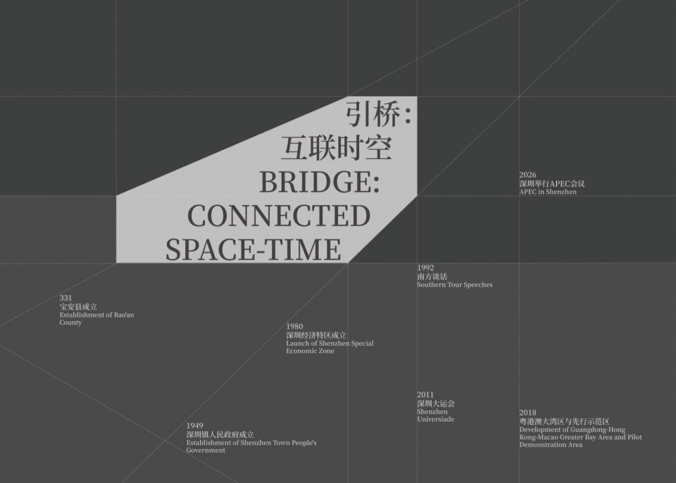
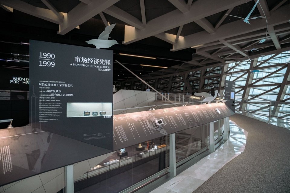
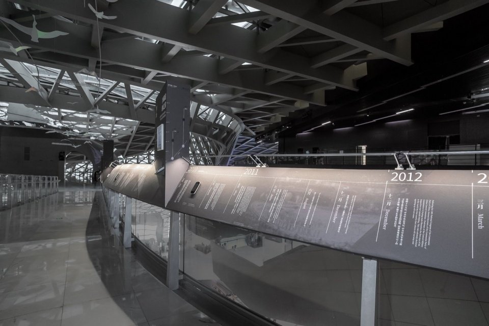
The first clue to “connected space and time” is time. The exhibition is based on the development history of Shenzhen, organizing policy breakthroughs, urban construction, industrial evolution, technological innovation and social life in different eras on a continuous timeline. From the establishment of special economic zones and the formation of “Shenzhen Speed” to technological waves such as the Internet, mobile communications, and artificial intelligence, Shenzhen’s development continues to respond to structural changes in China and the world.
Time is the first thread of “Connected Space-Time.” A continuous timeline brings together policy breakthroughs, urban construction, industrial change, technological innovation and everyday life. From the Special Economic Zone and “Shenzhen Speed” to the internet, mobile communications and AI, the city has continually responded to structural changes in China and the world.
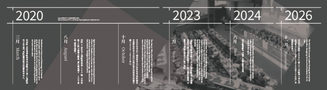
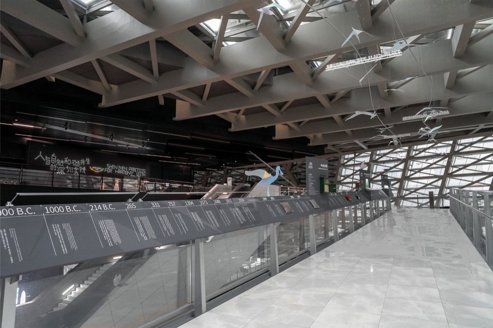
▼Shenzhen timeline (detail) © CABLE
But this timeline is not just a linear list of the city’s achievements, but rather juxtaposes Shenzhen’s development nodes with major global events of the same period, showing how a city constantly re-understands and defines itself in a changing world. From Bao’an County to the Special Economic Zone, from Shenzhen’s speed of “one floor in three days” to innovative breakthroughs in the era of the Internet and artificial intelligence, from the establishment of APEC and the birth of the World Wide Web, to China’s accession to the World Trade Organization and the rise of generative artificial intelligence, the two timelines are intertwined and together form the development trajectory of Shenzhen, and also show the coordinates of the city’s continuous connection with the world and participation in the global innovation process.
The timeline places local milestones alongside global events to show how Shenzhen continually redefines itself. Bao’an County’s transformation into a Special Economic Zone, the “one floor every three days” building pace and breakthroughs in internet technology and AI intersect with APEC’s founding, the birth of the World Wide Web, China’s WTO accession and the rise of generative AI. Together, these histories locate Shenzhen within global innovation.
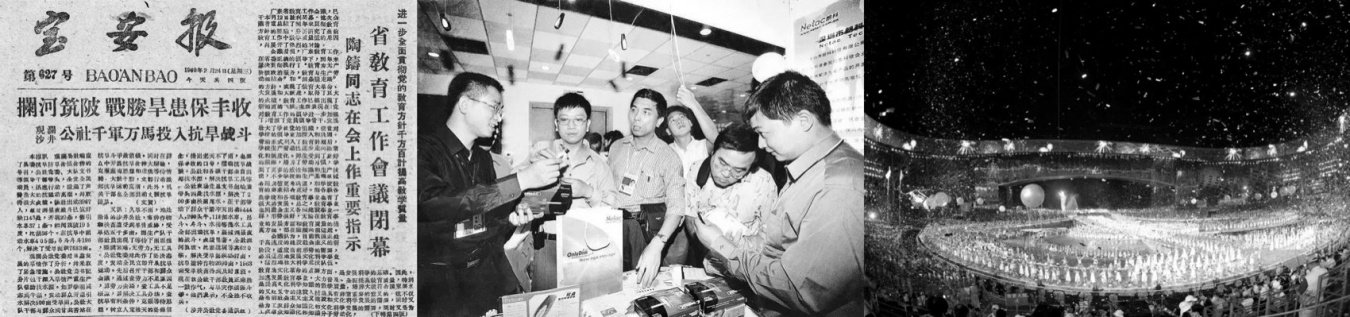
▼Picture (left): Baoan News on February 24, 1960; Picture (middle): October 5, 1999, at the first Hi-Tech Fair; Picture (right): The opening scene of the 2011 Universiade
Left: Bao’an Daily, 24 February 1960 Centre: The inaugural China Hi-Tech Fair, 5 October 1999 Right: Opening ceremony of the 2011 Universiade
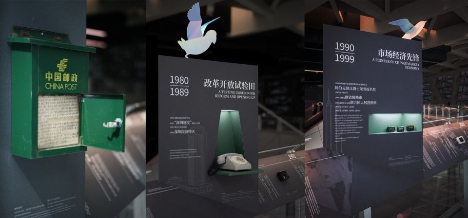
The timeline sets milestones with five decades as nodes and embeds communication devices such as letters, landline phones, pagers, computers and mobile terminals. These objects are not a simple restoration of the lifestyle of the old era, but a set of media interfaces for understanding the urban development of Shenzhen. From letters and landlines to mobile Internet, changes in communication methods also reflect the continuous expansion of communication distance: initially the connection between individuals and their hometowns, then the connection between the city and the national market, and finally extending to the real-time interaction between Shenzhen and global industry, technology and information networks. By compiling the oral histories of these Shenzhen builders and using touchable and operable interactive devices, the exhibition allows the audience to have a “dialogue” with city builders of different eras across time and space. As a result, the macroscopic history of urban development is transformed into perceptible personal experience; time no longer exists only in years and data, but is re-embedded in sounds, memories, and the way people connect with each other.
Milestones across five decades incorporate letters, landline phones, beepers, computers and mobile devices as interfaces to Shenzhen’s growth. Communication expands from ties with home to national markets and real-time global networks of industry, technology and information. Drawing on oral histories, hands-on installations let visitors “speak” with those who built the city in different eras. Urban history becomes personal experience, with time embodied in voices, memories and human connections.
▼Interactive milestone installations © CABLE
Therefore, this timeline not only tells how Shenzhen grew from a small border town to a modern city, but also shows how a rapidly developing city gradually forms a future-oriented urban outlook: development is not a one-way speed race, but a constant adjustment and search for a new balance between technological innovation, regional cooperation and natural symbiosis.
The timeline traces both Shenzhen’s transformation from a border town into a modern metropolis and its evolving vision of the future. Development becomes an ongoing search for balance between technological innovation, regional cooperation and coexistence with nature.
Space: From wetlands to Asia-Pacific networks
Space: From Wetlands to the Asia-Pacific
Simultaneously unfolding with the city’s timeline are spatial clues composed of migratory birds.
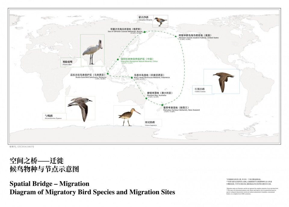
The exhibition is based on the East Asian-Australasian Flyway and connects Shenzhen with East Asia, Southeast Asia, Oceania and the Pacific Rim through the migration paths of black-faced spoonbills, spoon-billed sandpipers and Mongolian sand plover. For migratory birds, there are no administrative boundaries between cities. What they rely on is a cross-regional ecological network composed of tidal flats, wetlands, estuaries, forests and coasts.
Shenzhen Bay and Futian mangroves are at important nodes in this migration network. Migratory birds stop here to feed and replenish their energy before continuing across oceans and continents. As a result, Shenzhen is no longer just understood as an economic, technological city or administrative region, but has become a key location in the Asia-Pacific ecosystem.
Alongside the urban timeline, migratory birds reveal a spatial narrative.
Following the East Asian–Australasian Flyway, the routes of black-faced spoonbills, spoon-billed sandpipers and lesser sand plovers connect Shenzhen with East Asia, Southeast Asia, Oceania and the Pacific Rim. Birds cross administrative boundaries, depending on a regional network of mudflats, wetlands, estuaries, forests and coasts.
Shenzhen Bay and the Futian mangroves are vital stops where birds rest, feed and refuel before crossing oceans and continents. Shenzhen thus emerges as a key node in the Asia-Pacific ecosystem as well as an economic and technological centre.
▼Schematic diagram of migratory bird species and stopover nodes, Migratory bird species and stopover nodes © CABLE
This spatial perspective also responds to the concept of “interconnection” in the APEC context. Links between regions exist not only in trade, industry, technology and infrastructure, but also in water systems, climate, migration routes and species habitats. Migratory birds connect the Asia-Pacific region in a way older than cities. Regional collaboration not only means sharing development opportunities, but also sharing ecological responsibilities.
This perspective broadens APEC’s idea of connectivity. Regions are linked through waterways, climate, migration routes and habitats as well as trade, industry, technology and infrastructure. Birds have connected the Asia-Pacific since long before cities existed; regional cooperation means sharing ecological responsibility alongside development opportunities.
The intersection of time and space: Imagination for the future
Time and Space Meet: Imagining the Future
Time answers how Shenzhen got to where it is today, and space answers what kind of world Shenzhen is in.
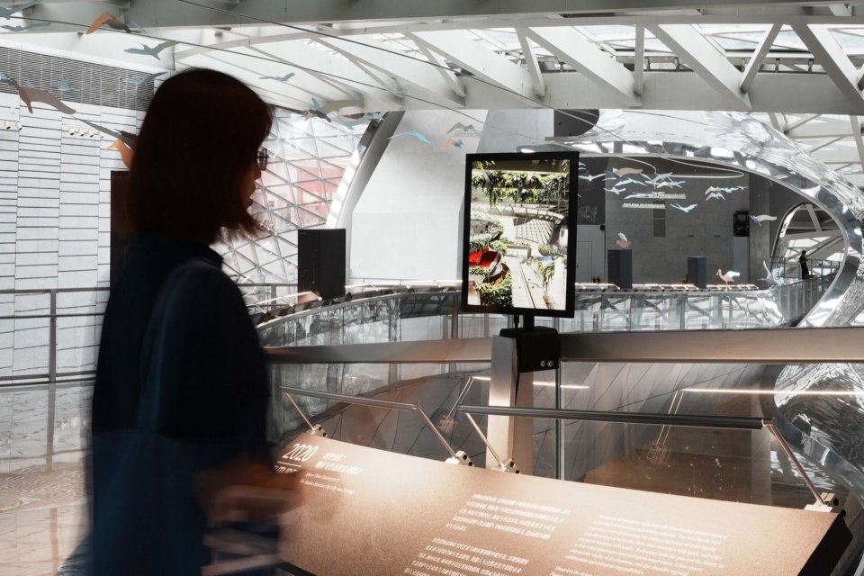
When the audience reaches the end of the approach bridge, they are no longer faced with a definite historical conclusion, but a picture of the future that is still being formed. The clues of time and space finally merge into the augmented reality (VR) device at the end. Through the digital interface, the audience can watch the ecological network, urban architecture and future images superimposed on the real atrium space of the venue. Here, Shenzhen’s development process intersects with the migratory bird migration network: technology connects the past and the future, as well as urban governance and ecological protection; urban space carries economic and social activities, as well as regional collaboration and ecological responsibility. Therefore, future cities will no longer be just expanding material containers, but should become platforms for governments, industries, the public and natural ecology to participate together.
Time explains how Shenzhen arrived here; space reveals the world it belongs to.
At the bridge’s end, visitors encounter a future still taking shape. Time and space converge in a visual reality installation, overlaying ecological networks, urban architecture and future scenarios onto the real atrium through a digital interface. Shenzhen’s development meets bird migration: technology links past and future, urban governance and conservation. Urban space supports economic and social life alongside regional cooperation and ecological responsibility. The city future becomes a shared platform for government, industry, the public and nature.
▼Augmented reality (VR) device, Visual reality installation © CABLE
Exhibition design
Exhibition Design
Exhibition hall in progress
An Exhibition in Motion
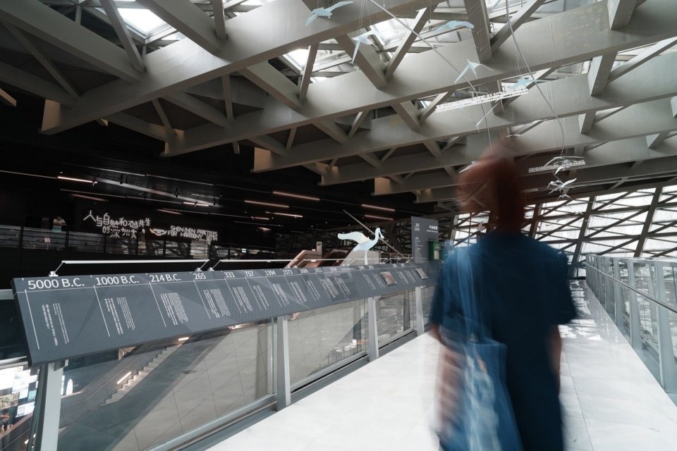
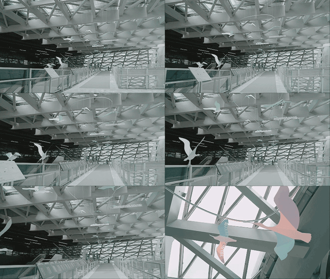
The exhibition design first responds to the long, narrow and continuous spatial characteristics of the approach bridge itself. The design does not treat the approach bridge into several independent exhibition items, but directly transforms the audience’s walking process into a reading process. The timeline continues to extend along the bridge. As the audience walks forward, they pass through different stages of Shenzhen’s development. The exhibition is therefore not a static display that stays at a certain viewing point, but an urban narrative driven by body movement.
The design follows the bridge’s long, continuous form, turning movement into reading. As the timeline unfolds along the bridge, visitors walk through successive stages of Shenzhen’s development. The exhibition becomes an urban narrative experienced through motion.
▼Access space, Exhibition site © CABLE
The original traffic attributes of the approach bridge have also been retained to the maximum extent. It still connects different exhibition halls in the building, but after the intervention of the exhibition, this physical connection has been given new meaning: the process of the audience moving from one space to another has also become a process from urban history to regional ecology, and then from reality to the future.
The bridge retains its role connecting galleries, while gaining new meaning. Moving between spaces also becomes a journey from urban history to regional ecology, and from the present into the future.
▼Walking through the bridge © CABLE
Through vertical layering, the spatial design transforms “time” and “space” into on-site relationships that can be intuitively perceived.
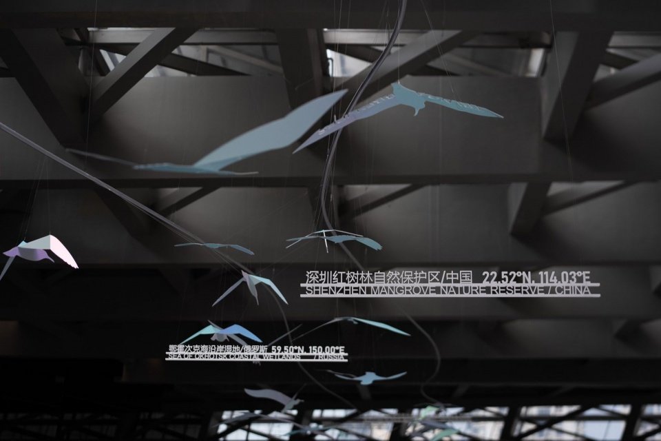
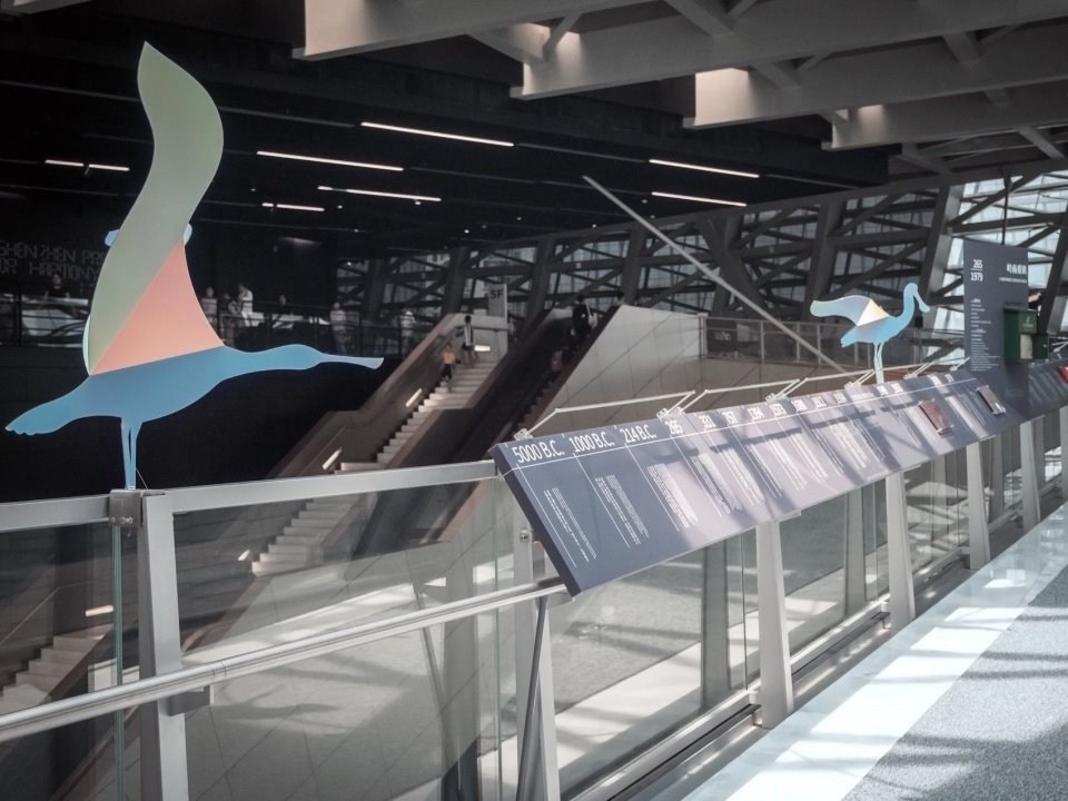
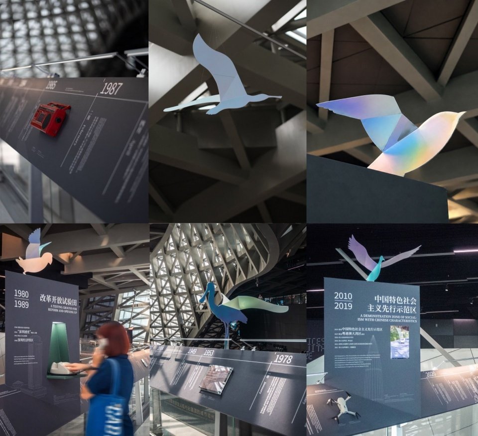
The long, dark-colored display panels unfolded along one side of the approach bridge carry the Shenzhen timeline, forming a continuous and stable baseline for urban development. In contrast, a large number of thin bird-shaped components are suspended under the roof structure above the approach bridge. They are distributed between building trusses at different heights, directions and postures, and together with migration distance, ecological nodes and regional information form an aerial path across the Asia-Pacific. When the audience looks forward, they read about the development time of Shenzhen; when they look up, they feel the migration space beyond the city boundaries. The body moves forward along time, but the line of sight is constantly directed to a wider regional network. Time and space are no longer just abstract concepts in words, but become spatial structures that simultaneously affect walking, viewing and perception.
Vertical layers make the relationship between time and space tangible.
A long, dark panel carries Shenzhen’s timeline along one side of the bridge, forming a steady baseline. Above, lightweight bird forms hang among the roof trusses at varied heights, angles and poses. Migration distances, ecological nodes and regional information map an aerial route across the Asia-Pacific. Looking ahead, visitors read urban time; looking up, they encounter migration city beyond boundaries. Walking, looking and sensing bring time and space into one physical experience.
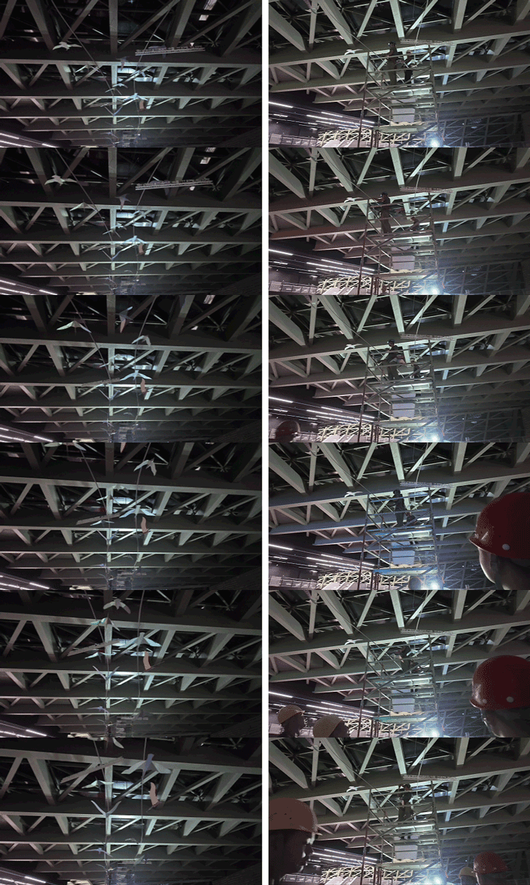
▼Construction process, Installation in progress ©CABLE
▼Birds in “migration” © CABLE
Lightweight construction
Lightweight Construction
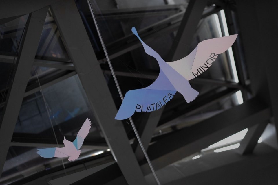
Faced with the complex and powerful steel structure, trusses and skylights of the atrium, the installation design chose a relatively light intervention method. The bird shapes in different postures such as flying, gliding, and resting are all made of bent aluminum plates, and the surface is covered with a matte illusion film. The light and thin metal plates not only ensure the structural strength required for the hanging components, but also weaken the volume of the physical device, making the birds seem to be walking between the building beams.
Against the atrium’s powerful steelwork, trusses and skylights, the installation takes a light touch. Birds in flight, gliding and resting are folded from aluminum sheets coated with matte iridescent film. The thin metal provides strength while reducing visual bulk, making the flock appear to move through the structure.
▼Bird installation © CABLE
▼Migration corridor, Migration corridor ©Shenzhen Museum of Contemporary Art and Urban Planning
As the viewer’s perspective and natural light change, the surface of the phantom film shows subtle and flowing colors, forming a light and restrained visual hierarchy in the background of the gray steel structure. The installation does not block the original building, but relies on the height and height of the suspension to form a dynamic migration path together with the trusses, skylights and atrium light and shadow, making “flow in space” an exhibition language that can be directly perceived.
Changing viewpoints and daylight create subtle shifts of color against the gray steelwork. Suspended at varying heights, the birds leave the architecture visible and combine with trusses, skylights, light and shadow to form a dynamic migration route. Movement through space becomes a tangible exhibition language.
▼Birds at “rest” © CABLE
The timeline is arranged along the glass railings, with a lower continuous interface attached to the edge of the approach bridge. While maintaining traffic and considering the direction of the exhibition sight lines, the originally scattered exhibition items are integrated into a complete narrative path. The exhibition does not build a new space, but uses the orientation, scale and structure of the existing building to make the approach bridge itself a narrative device. Nodes of different eras are designed as “milestones” that protrude outward, interrupting the flat surface of time and suggesting key turning points in urban development.
The timeline follows the glass balustrade as a low, continuous surface, preserving circulation and sightlines while unifying separate exhibits into a narrative route. The design uses the building’s existing orientation, scale and structure to make the bridge itself a storytelling device. Projecting “milestones” mark key turning points in the city’s growth.
▼”Milestone” nodes, Milestone nodes © CABLE
▼Exhibition site © CABLE
▼Exhibition details © CABLE
General exhibition title: Shenzhen Narrative: Urban Practice of Harmonious Coexistence between Man and Nature
Guiding unit: Shenzhen Municipal Planning and Natural Resources Bureau
Organizer: Shenzhen Museum of Contemporary Art and Urban Planning
Chief planning/coordinator: Shenzhen Urban Planning Museum
Opening hours: August 11, 2026 – December 31, 2026
Exhibition Section Name: Approach: Interconnected Time and Space
Building area: 171.5㎡
Design time: 2026
Completion time: 2026
Exhibition planning: CABLE
Curating team: He Liu, Lu Xueting, Chen Pei, Zeng Heng
Exhibition design: Ziji fabersociety
Design team: Zuo Long, Hu Yue, Wang Yifan, Zhao Qifan, Chen Yaxue, Wei Bojun
Construction team: Lezao Exhibition Service
Photography: CABLE, Shenzhen Museum of Contemporary Art and Urban Planning
Project Address: 5th Floor, Contemporary Art and Urban Planning Museum, Fuzhong Road, Futian District, Shenzhen City, Guangdong Province, China
Overall exhibition: Shenzhen Narratives: The Urban Practices for Harmony with Nature
Guidance: Shenzhen Municipal Planning and Natural Resources Bureau
Host: Shenzhen Museum of Contemporary Art and Urban Planning
Overall planning and coordination: Shenzhen Urban Planning Museum
Dates: 11 August–31 December 2026
Exhibition section: Bridge: Connected Space-Time
Floor area: 171.5 m²
Design: 2026
Completed: 2026
Curation: CABLE
Team: He Liu, Lu Xueting, Chen Pei, Zeng Heng
Exhibition design: Fabersociety
Team: Zuo Long, Hu Yue, Wang Yifan, Zhao Qifan, Chen Yaxue, Wei Bojun
Construction: LEZAO
Photography: CABLE; Shenzhen Museum of Contemporary Art and Urban Planning
Location: Level 5, Shenzhen Museum of Contemporary Art and Urban Planning, Fuzhong Road, Futian District, Shenzhen, Guangdong, China
More:CABLE+ fabersociety . More about them:CABLE on gooood, fabersociety on gooood
Source: gooood.cn