














grateful INI Design Studio Share the following content with gooood. More about:INI Design Studio on gooood
Appreciation towards INI Design Studio for providing the following description:
For decades, Surat’s relationship with the Arabian Sea has been shaped by a fragmented and underutilized coastline. The Dumas Waterfront Master Plan reimagines this edge as a vibrant coastal landscape, transforming a neglected waterfront into a resilient public realm where ecology, civic life and urban identity converge. Located along the historic Dumas coast, the project responds to the growing demand for high-quality public open spaces in Surat, one of India’s fastest-growing cities. Despite its long-standing cultural and recreational significance, fragmented development, limited accessibility, and the lack of a unified vision have always constrained the potential of the shoreline. The masterplan addresses these challenges by stitching disconnected passages into a continuous waterfront experience, reconnecting the city to the sea.
For decades, Surat’s relationship with the Arabian Sea was shaped by a fragmented and underutilized shoreline. The Dumas Sea Face Masterplan reimagines this edge as a living coastal landscape, transforming a neglected public realm into a resilient public realm where ecology, civic life, and urban identity converge. Located along the historic Dumas coastline, the project responds to the growing demand for high-quality public open space in one of India’s fastest-growing cities. Despite its long-cultural standing and recreational significance, fragmented development, limited accessibility, and the absence of a cohesive vision had constrained the shoreline’s potential. The masterplan addresses these challenges by stitching together disparate segments into a continuous waterfront experience that reconnects the city with the sea.
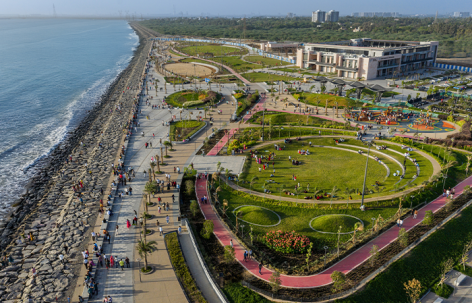
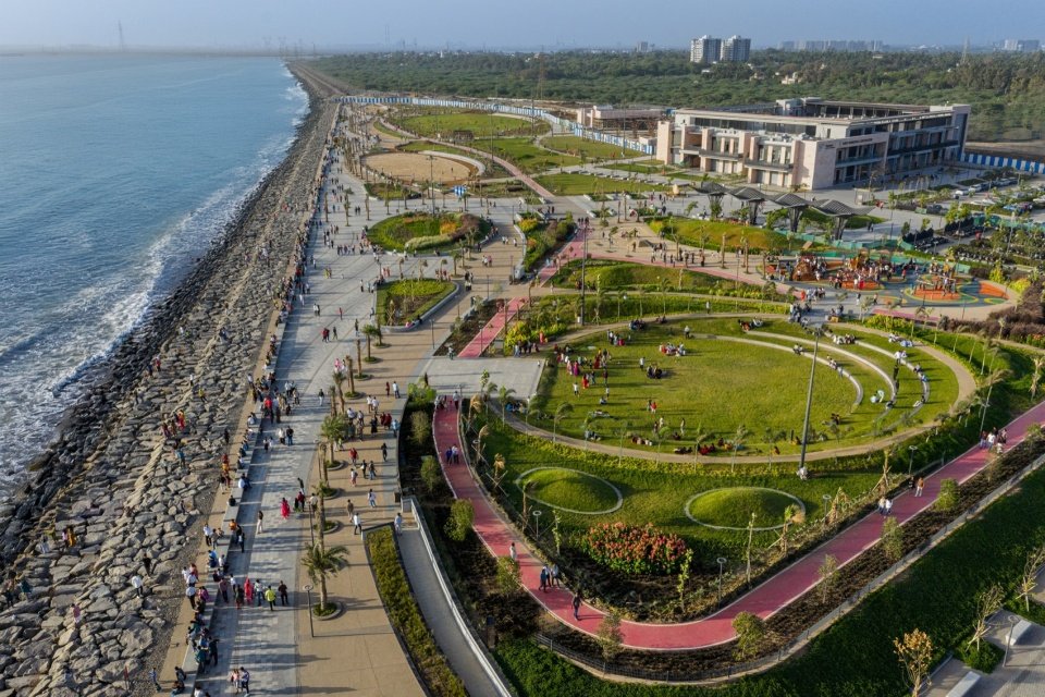
▼Overview of the Dumas Sea Face, Overview of the Dumas Sea Face © Vinay Panjwani
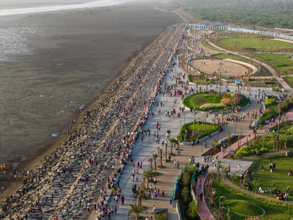
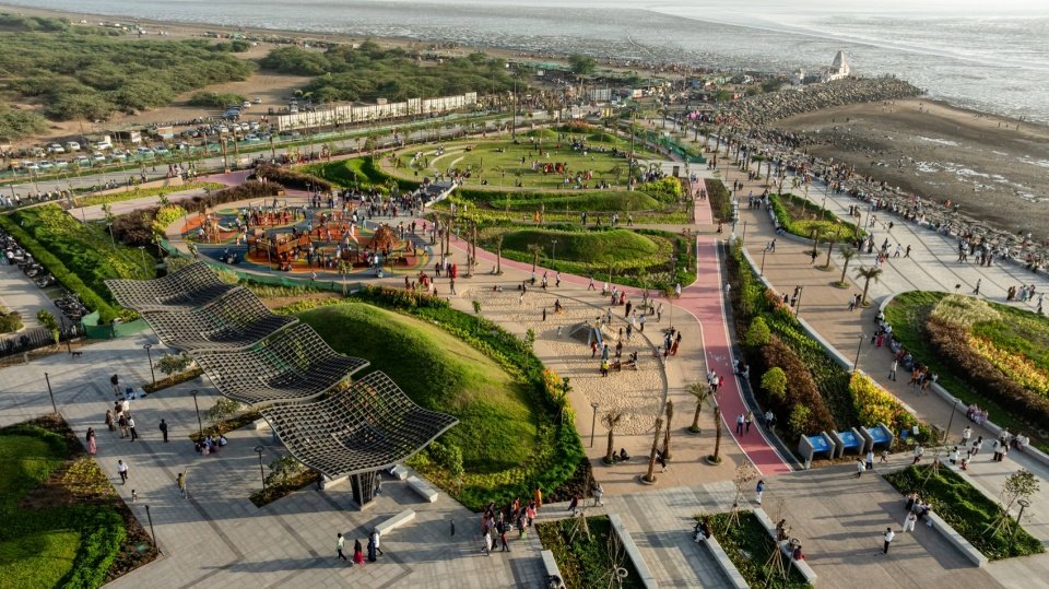
▼top view of the Dumas Sea Face © Vinay Panjwani
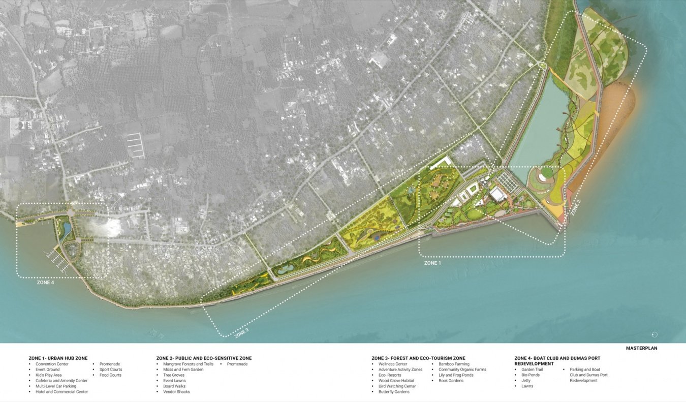
The 252.2-acre master plan is divided into four areas, of which a 31.8-acre area is now open to the public and has become a hub for leisure, tourism and public life. At the heart of the proposal lies a fundamental shift in the way coastal infrastructure is conceived: instead of conceiving of the coastline as a rigid boundary, the design conceives of it as a fluid and habitable zone that accommodates movement, agglomeration, ecological processes and seasonal changes. A continuous promenade forms the organizational backbone, linking plazas, performance spaces, play areas, observation decks and quiet retreats along the waterfront.
▼The site before development and under construction, the site before development and under construction © INI Design Studio
The 252.2-acre masterplan is organized into four zones, with the 31.8-acre Zone-1 now open to public, serving as a hub for recreation, tourism, and public life. At the heart of the proposal lies a fundamental shift in how coastal infrastructure is conceived. Rather than treating the shoreline as a rigid boundary, the design envisions it as a fluid and inhabitable zone accommodating movement, gathering, ecological processes, and seasonal change. A continuous promenade forms organizing the spine, connecting plazas, performance spaces, play areas, viewing decks, and quieter retreats along the waterfront.
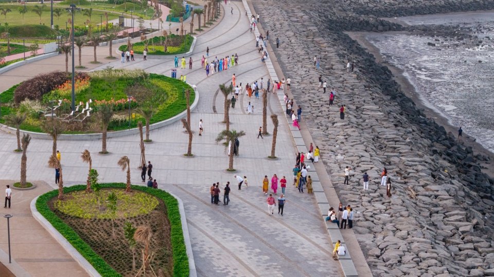
▼The promenade and the rocky shore © Vinay Panjwani
▼The promenade close view © Vinay Panjwani
▼The seaside cycling track, the seaside cycling track © Vinay Panjwani
One of the project’s defining features is its emphasis on “iconicity” – the ability of a place to create a strong and memorable identity. The master plan draws on Kevin Lynch’s urban design principles to integrate paths, boundaries, nodes and landmarks into a coherent framework that enhances the sense of orientation while cultivating a unique sense of place. Sculptural installations anchor key points along the promenade; paving, street furniture, shading and lighting are designed to draw on the fluid geometry of the ocean’s forms, establishing a recognizable seaside character rooted in the coastal environment.
A defining aspect of the project is its emphasis on imageability—the ability of a place to create a strong and memorable identity. Drawing from Kevin Lynch’s urban design principles, the masterplan integrates paths, edges, nodes, and landmarks into a coherent framework that enhances orientation while fostering a distinct sense of place. Sculptural installations anchor key nodes along the promenade, while fluid geometries inspired by marine forms inform the design of paving, street furniture, shading structures, and lighting, establishing a recognizable waterfront character rooted in in its coastal setting.
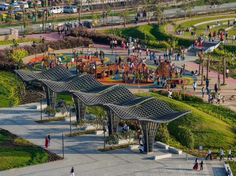
▼Aerial view of the play area and shade pavilions © Vinay Panjwani
▼shade structures and the plaza, shade structures and the plaza © Vinay Panjwani
▼Wavy awning, the undulating shade canopy © Vinay Panjwani
Resilience forms the basis of the project’s environmental strategy. The master plan does not rely on traditional hard-engineered coastal defenses, but adopts a layered strategy that works with natural systems: natural stone shore edges, porous coastal interfaces, and intertidal zones dissipate wave energy while allowing tidal movements and sediment transport to continue; permeable pavements, bioretention facilities, and integrated stormwater systems reduce runoff, promote groundwater recharge, and alleviate flooding; native salt-tolerant plants increase biodiversity, improve microclimate comfort, enhance ecological stability, and reduce long-term maintenance needs.
Resilience forms the foundation of the project’s environmental strategy. Instead of relying on conventional hard-engineered coastal defenses, the masterplan adopts a layered approach that works with natural systems. Natural stone edges, porous coastal interfaces, and intertidal zones dissipate wave energy while allowing tidal movement and sediment transport to continue. Permeable surfaces, bioswales, and integrated stormwater systems reduce runoff, facilitate groundwater recharge, and mitigate flooding. Native salt-tolerant planting enhances biodiversity, improves microclimatic comfort, and strengthens ecological stability while reducing long-term maintenance requirements.
▼Ornamental grass beds © Vinay Panjwani
The waterfront also enhances the cultural significance of Dumas through inclusive and accessible public spaces that support a wide range of activities, from everyday leisure to festivals, exhibitions and community gatherings. Barrier-free trails, seating and supporting facilities ensure accessibility for all users, while marine interpretive elements cultivate public environmental awareness. The integration of the historic Dariya Ganesh Temple further enhances the cultural continuity of the site – a reimagined ceremonial axis connects the urban fabric to the waterfront.
The waterfront also reinforces Dumas’ cultural significance through inclusive and accessible public spaces that support a broad spectrum of activities, from everyday recreation to festivals, exhibitions, and community gatherings. Barrier-free pathways, seating, and amenities ensure accessibility for all users, while marine interpretation elements foster environmental awareness. The integration of the historic Dariya Ganesh Temple further strengthens the site’s cultural continuity, with a reimagined ceremonial spine connecting the urban fabric to the waterfront.
▼top view of the circular lawn amphitheater, top view of the circular lawn amphitheater © Vinay Panjwani
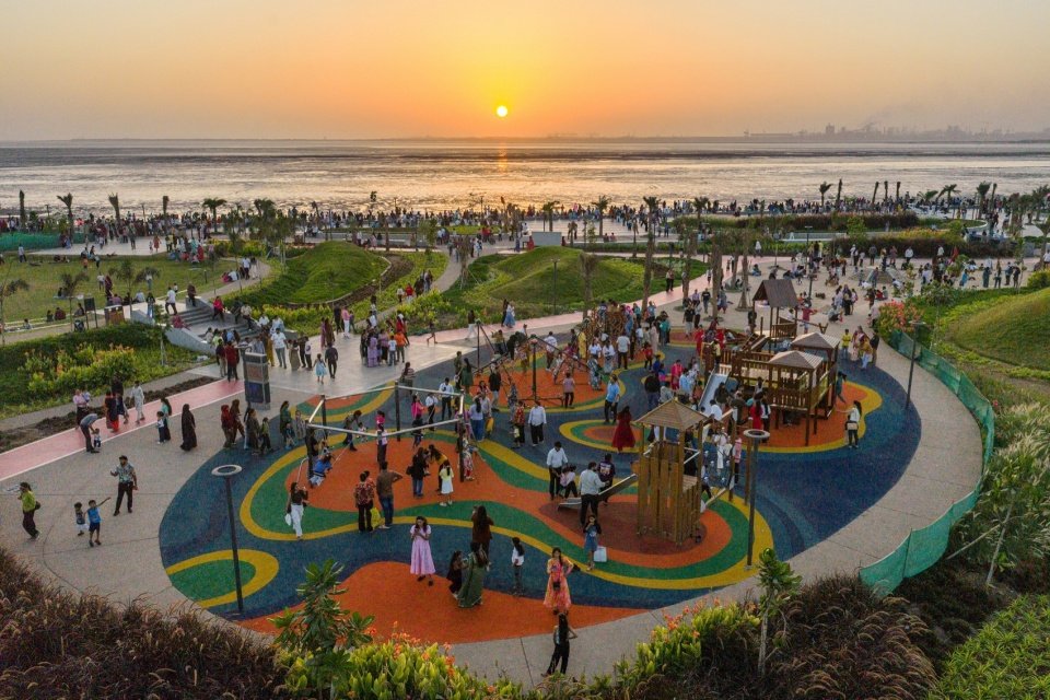
▼The children’s playground and the sand play area © Vinay Panjwani
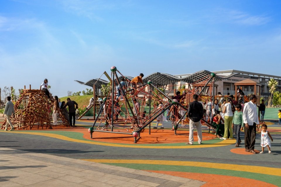
▼Climbing play structures, climbing play structures © Vinay Panjwani
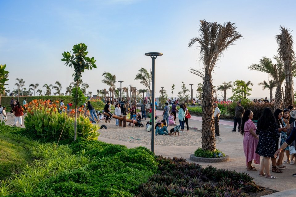
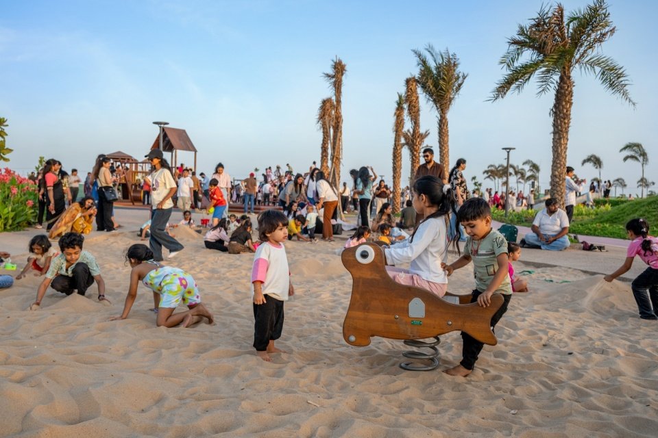
▼The sand play area, the sand play area © Vinay Panjwani
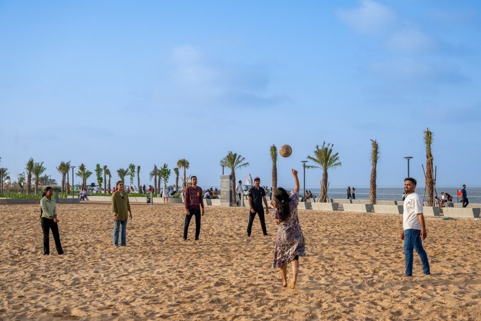
▼Beach activities, activities on the beach © Vinay Panjwani
Since its opening in March 2026, the park has welcomed more than 1.2 million visitors, confirming the project’s status as an important civic destination in Surat. More than just a waterfront development, the Dumas Waterfront Master Plan sets a new paradigm for climate-responsive coastal urbanism, redefining the city’s relationship with the sea.
Since its opening in March 2026, the park has welcomed more than 1.2 million visitors, demonstrating the project’s role as a major civic destination for Surat. More than a waterfront development, the Dumas Sea Face Masterplan establishes a new model for climate-responsive coastalism and redefines the city’s relationship with the sea.
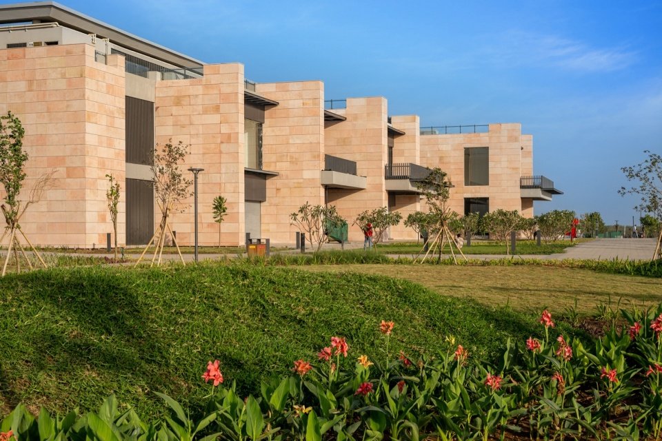
▼The supporting buildings in the park, the amenity building © Vinay Panjwani
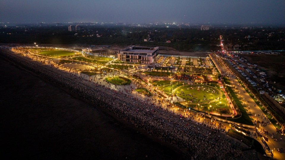
▼Dumas Sea Face at dusk © Vinay Panjwani
▼The sea face at night © Vinay Panjwani
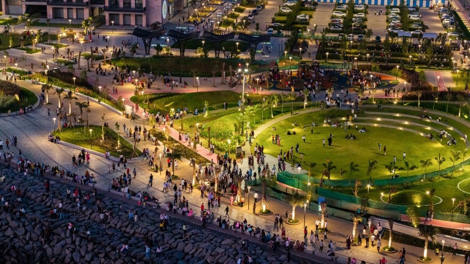
▼The circular lawn at night, the circular lawn at night © Vinay Panjwani
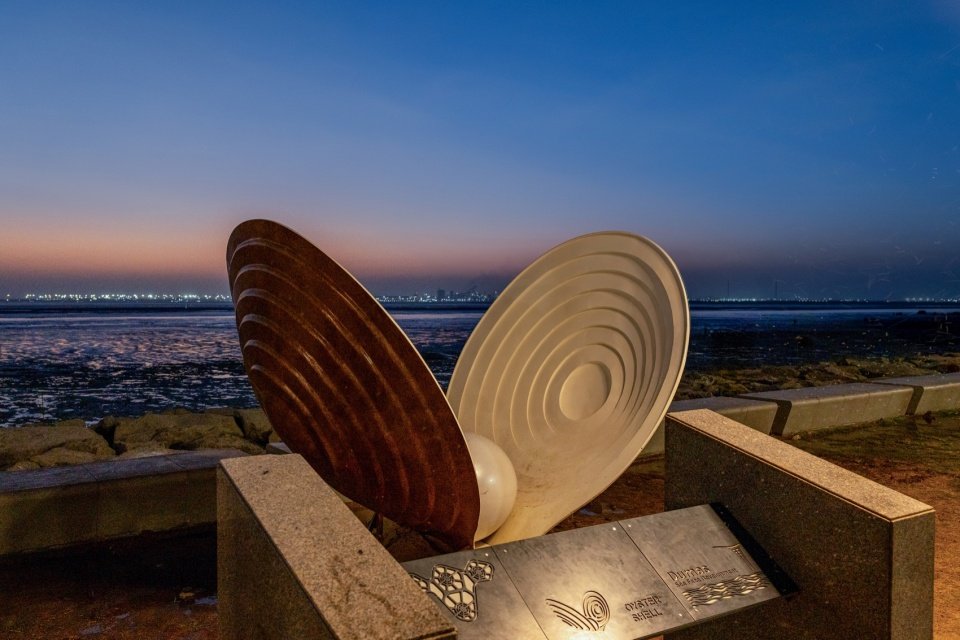
▼The marine-inspired sculptural installation night view, the marine-inspired sculptural installation night view © Vinay Panjwani
▼General floor plan, masterplan © INI Design Studio
Project name: Dumas Sea Face Masterplan
Location: Dumas, Surat, Gujarat, India
Year of completion: 2026 (Zone 1 will open in March 2026)
Site area: 252.2 acres (including 31.8 acres in one area)
Function: waterfront space, public space, seaside community space
Owner: Surat Municipal Corporation (SMC)
Master planning, architecture and landscape design: INI Design Studio
MEPF and Infrastructure Engineering: INI Infrastructure & Engineering
Lighting Design: INI Infrastructure & Engineering
Structural Engineering: Global Marine
Irrigation Consultant: Integrated Flow tech Pvt. Ltd.
Construction: MP Babaria Construction and Unique Construction
Project Mentor: Jayesh Hariyani; Project Director: Harsh Goel; Senior Project Manager: Pathik Gandhi
Design Team: Priyank Bhavsar, Harshad Raval, Sejal Gajjar, Vishal Ameta, Vikas Saket, Ankit Shroff, Vishek Yadav, Heenal Chavda, Eklavya Koralkar, Venkatesh Bhagat, Rushikesh Wadnere, Sanchita Shah
Engineering Team: Amit Mehta, Niket Vora, Vipul Dalwadi
Photography: Vinay Panjwani
Site record photos and drawings: © INI Design Studio
Project: Dumas Sea Face Masterplan
Location: Dumas, Surat, Gujarat, India
Completion: 2026 (Zone-1 opened in March 2026)
Site area: 252.2 acres (Zone-1: 31.8 acres)
Program: waterfront, public space, sea front community space
Client: Surat Municipal Corporation (SMC)
Master planning, architecture & landscape design: INI Design Studio
MEPF & infrastructure engineering: INI Infrastructure & Engineering
Lighting design: INI Infrastructure & Engineering
Structural engineering: Global Marine
Irrigation consultants: Integrated Flow tech Pvt. Ltd.
Contractor: MP Babaria Construction in JV with Unique Construction
Project Mentor: Jayesh Hariyani; Project Director: Harsh Goel; Senior Project Manager: Pathik Gandhi
Design team: Priyank Bhavsar, Harshad Raval, Sejal Gajjar, Vishal Ameta, Vikas Saket, Ankit Shroff, Vishek Yadav, Heenal Chavda, Eklavya Koralkar, Venkatesh Bhagat, Rushikesh Wadnere, Sanchita Shah
Engineering team: Amit Mehta, Niket Vora, Vipul Dalwadi
Photography: Vinay Panjwani
Site record photos & drawings: © INI Design Studio
More:INI Design Studio More about:INI Design Studio on gooood
Source: gooood.cn